


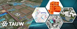
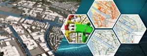
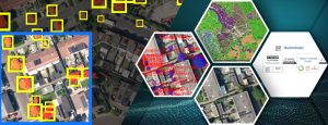
From design to impact: TAUW on climate-adaptive design with Tygron
Climate adaptation requires smart solutions that are both effective and efficient. Ruben Keizer and Len Geisler of Tauw Consultancy and Engineering demonstrate how data-driven design using Tygron can accelerate and improve the process of climate-resilient urban projects.
Standardized heat stress analyses for Amsterdam
Urban heat is a structural challenge and demands policy adjustments. Clara Keuken and Tom Remijn, water and climate adaptation consultants at Ingenieursbureau Amsterdam, will explain at the Tygron user day how they approach heat stress analyses in the capital.
Get started with AI yourself: Open source and accessibility on the Tygron Platform
The world of artificial intelligence (AI) can sometimes seem complex and inaccessible, but the Tygron Platform proves that this does not have to be the case. With a focus on
How do we use AI to better retain precipitation where it falls?
Challenge The Netherlands is facing a growing water management problem: the groundwater level drops too far in dry summers, leading to the drying out of agricultural land, nature reserves and
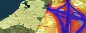
Calculating the entire Netherlands on demand with a supercomputer
Tygron CTO Maxim Knepflé: “Calculating the entire Netherlands with SimNL offers many advantages” During a recent session at the Tygron Community of Practice, CTO Maxim Knepflé delved deeper into the

Digital Twins for Spatial Planning: Innovation Driven by Experiments, Hackathons, and Technological Integration
Digital Twins are rapidly emerging as a revolutionary tool for addressing the complex challenges of our environment. This technology promises a new way of working, but it is not yet
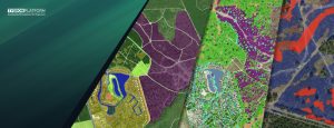
Getting a grip on scenarios for the design of greenery: Esri and Cobra on steroids with the Tygron Platform
Suppose you are a policy officer and you are concerned with the future green design of your municipality. You must take complex aspects such as flooding, heat stress and affordability
Unlocking the Power of High-Performance Computing for Complex Engineering Projects
Introduction to High-Performance Computing (HPC) Engineers are dealing with large amounts of data to face the challenges of increasingly complex use-cases in built environments. There is a lot of information
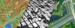
From GIS to Advanced Modeling: Get More out of your GIS Data with the Tygron Platform
The Tygron Support team often receives the question: we already have GIS software, why should we use the Tygron Platform? In this article, we describe the differences, overlaps, and complementarities
The Technological Backbone of the Tygron Platform: GPU Power, Interoperability, and GIS-Based Modeling
At Tygron, we understand that as an engineer, you aim to stay at the forefront of technological innovation, seeking robust solutions tailored to meet the demanding needs of modern engineering

Data driven approach to climate challenges and biodiversity using smart combinations of Tygron and FME
GAES is a consultancy for greening and climate challenges, biodiversity objectives and social issues. Central to their data-driven concept is the role of ecosystem services. Ecosystem services include all goods
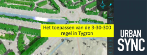
3-30-300 for healthier urban living with Urban Sync
The 3-30-300 rule is a rule of thumb for urban forestry and urban greening that was developed by Professor Cecil Konijnendijk, director of the Nature Based Solutions Institute. This rule states
