Challenge
The Netherlands is facing a growing water management problem: the groundwater level drops too far in dry summers, leading to the drying out of agricultural land, nature reserves and urban green zones. Due to climate change, these dry periods are becoming more frequent and more severe.
An important strategy to counter this is to retain rainwater where it falls. This means that rainwater should not be discharged directly via the surface water system, but should be retained locally to raise the groundwater level.
However, to take effective measures, we need accurate data on where water is retained and how it moves. Current topographic maps fall short in this regard, especially outside urban areas. This hampers the ability of water boards to create detailed models and take targeted measures.
Innovative solution: RCNN-based data analysis
State-of-the-art AI techniques, such as Region-based Convolutional Neural Networks (RCNN), offer a solution. This technique can automatically identify different types of vegetation and soil structures, such as heath, grass, sand, trees and agricultural crops, based on satellite images and aerial photographs. This allows us to generate detailed maps of microrelief, infiltration capacity and roughness (Manning coefficients).
Example from Otterlo
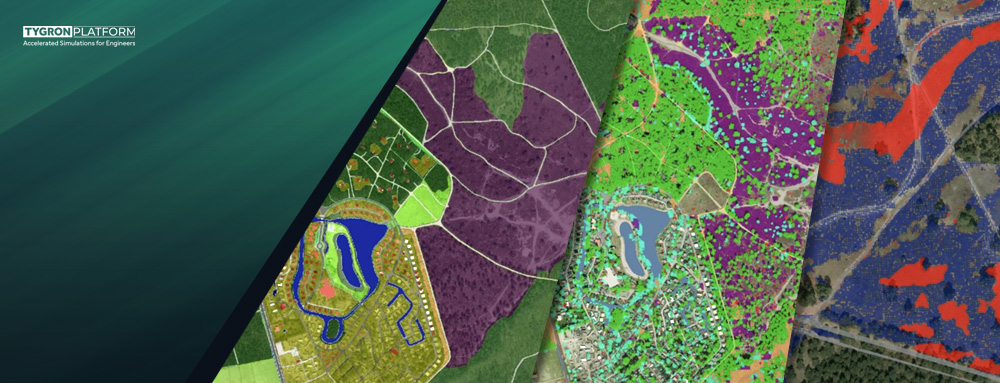
Together with the Vallei en Veluwe water board, we analyzed a test area near Otterlo. The first image shows the current situation according to the topographic map “Physical occurrence 2023” (STOWA, water damage estimator).
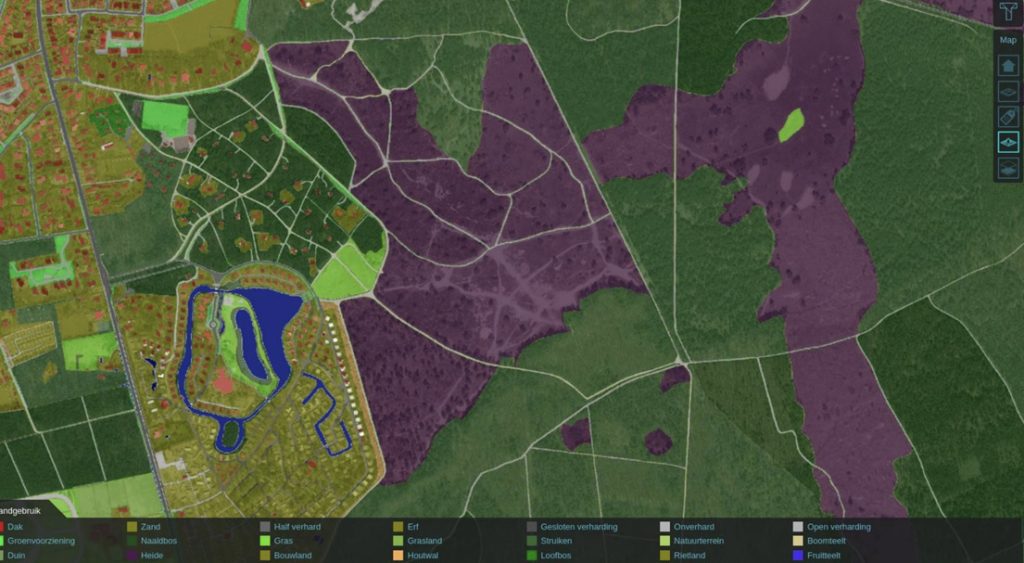
The second image shows the result of the RCNN model. This shows that there is much less heath (purple) in this area than the topographic map suggests. This has direct consequences for the amount of microrelief and thus the water storage in the area.
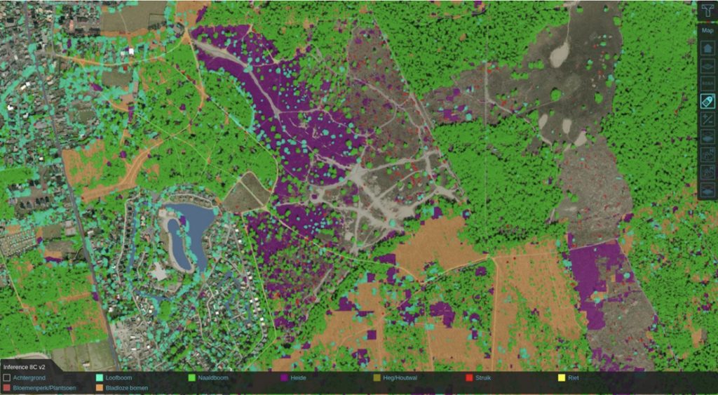
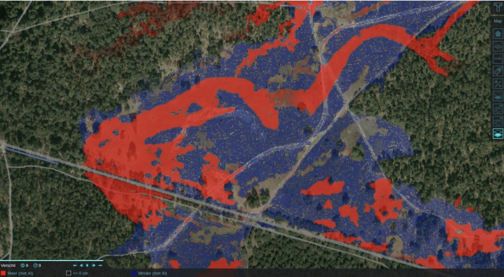
The effect of these differences on water levels during a 30 mm rain shower is shown in the following figure. More water flows from right to left, resulting in higher water levels (red) in the area on the left, at the expense of the higher area on the right (blue).
Expected benefits
- Better data resolution: Large homogeneous areas (such as one category “heath”) are replaced by fine-meshed grids with unique values per cell.
- Targeted measures: Water boards can see more accurately where water is retained and where there are opportunities to improve this.
- Open innovation: The developed models and methodologies are shared open source, so that other water boards and experts can use and improve them.
Application and future
This approach offers directly usable results for water boards, such as the Vallei en Veluwe water board. Furthermore, the model can serve as a blueprint for a national rollout. By applying this technology on a larger scale, water boards can improve their groundwater management and contribute to a more sustainable water system.
In addition, the open source nature of this project stimulates collaboration and knowledge sharing within the water sector, allowing innovative solutions to be developed more quickly.
Open source data
The developed RCNN model is available in the open-source format Open Neural Network Exchange (ONNX). This model can be used in platforms such as PyTorch. The data and results are accessible via Tygron GeoShare and include:
- Detailed GeoTIFF files of the Veluwe area (40×40 km) with a resolution of 1×1 meter.
- Maps of microrelief, litter layers and combined layers.
With this data, water boards and other stakeholders can immediately start to retain rainwater better locally and thus contribute to more robust water management for the future.
Want to know more?
