Scenario’s
You can now switch between Scenarios during a test run, directly from the Ribbon bar. This makes it possible to compare different solutions/ plans without having to exit a test run […]
Improved Measure Editing
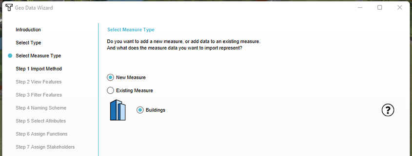
Measures can now also include a GeoTIFF, and the Geo Import Wizard allows for adding buildings to already existing Measures
Dynamic Weir
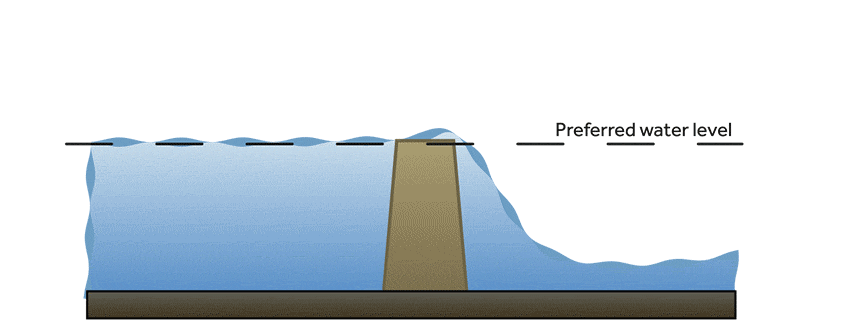
Added a weir drop water level threshold, making weirs respond more dynamically.
Password management/ force minimum number of characters
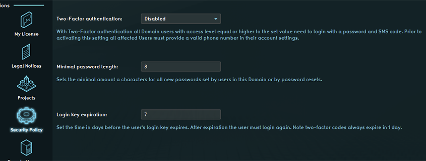
Domain Admins can force a minimum amount of characters in new passwords. Related documentation: Account management – Tygron Preview Support Wiki
2-Factor authentication
Domain Admins can now set two-factor authentication per user level. This adds an extra security layer to accessing the Tygron Geodesign Platform. Related documentation: Account management – Tygron Preview Support […]
Grid feedback
Provide feedback on the optimal grid size choise for different (water) calculations
Securing indicators
Securing indicators with a ‘lock’ will enhance sharing indicators with others on the owners own terms and conditions.
Switch to other version of project more easily
If I want to switch to another version of my project, I first have to close Tygron, restart, change the settings of the project in my account, then start the […]
Map scale and compass
Would it be possible to add the option to insert a map scale and a compass under tools -> screenshot. This way we could directly insert images and gifs into […]
Geometry Color
The GEOMETRY_COLOR attribute enables the option to update the color of functions, specified by attribute, by using a Tygron Query Language (TQL) query. It actually does not overwrite the color, […]
